What a wonderful blustery day it turned out to be!
With
the weather forecast threatening rain, rail and strong winds, seven
Walkabouters met at Mount Martha Park for a circuitous walk through the
park lands, bush and along waterways of Mount Martha.
Mount Martha is a coastal township located 60 kilometers south-east of Melbourne, on the south-eastern shore of Port Phillip Bay. The peak of Mount Martha was named after Martha Lonsdale, the wife of colonist William Lonsdale who supervised the founding of the settlement of Port Phillip in the 1830's.
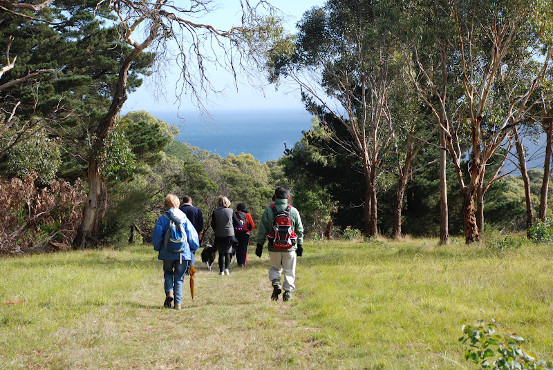
We followed the road leading out of the park and crossed over and entered a local paddock with an unlocked gate.
A foot-pad lead us through the paddock and remnant bushland,
although there was a good layer of blackberries in the undergrowth.
We soon came upon Sunshine Creek and we followed the track down towards where it flows into Port Phillip Bay.
We passed flowering native trees and plants,
and local resident's backyards!
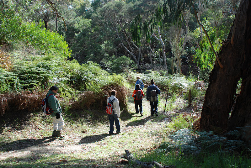
The indigenous flora and fauna has been squeezed into small pockets of bushland
that line creeks, ravines and estuaries that prove to be too difficult to clear and build residential housing.
We caught glimpses of the Bay and weaved our way through the lane ways
that divided residences and linked various parks and reserves.
Arriving at our lunchtime,
we were met by some local fishery management personnel,
and some very welcome friends!
We enjoyed our lunch and chatting and catching up on news with dear friends.
The Belcombe Estuary provided some great views.
We left our luncheon spot behind,
and walked along the track that follows the estuary inland for a short distance.
A group photo opportunity presented itself,
as the our paths soon took us different directions.
 |
| Say cheese! |
The track and board walk, that have been constructed in the Belcombe and Ferrero Reserve, provided a leisurely stroll for our short distance walkers.
The walkers who chose to the longer route, followed the path up hill,
through reserves and along residential streets
and even through the local golf course.
We soon made it back to Mount Martha Park.
After a brief rest and discovering some extra energy in our legs,
four Walkabouters set off on the challenging treck to the Summit of Mount Martha.
With almost all of our reserves exhausted we made it to top of Mount Martha.
Another Victorian Peak in the bag!!
 |
| Here we are! |
Just don't tell anyone that the summit of Mount Martha is only 166 ms above sea level!
To all our friends who weren't able to make the walk today, we look forward to walking with you on our next walk.
Walkabouters Club of Victoria Inc.
A0019863A