Today six Walkabouters walked up a hill.
Who's hill? Andrews Hill, in Kinglake National Park.

It is only two and a half years age since the devastating bushfires that destroyed much of the forest and townships in and around Kinglake National Park. Many of the local communities are still struggling to recover and rebuild from this traumatic event.
We decided it was time to visit this well known National Park 50 kilometers northeast of Melbourne to see how the bushland is recovering from the bushfires.

We met early in the morning at the Island Creek Picnic Ground in the
Wombelano Block of Kinglake National Park. The effects of the bush fires
were very evident. New signage and picnic tables had been built to replace
what was lost to the fire.

The bridges had also been replaced which was good,
otherwise we would have got really wet!

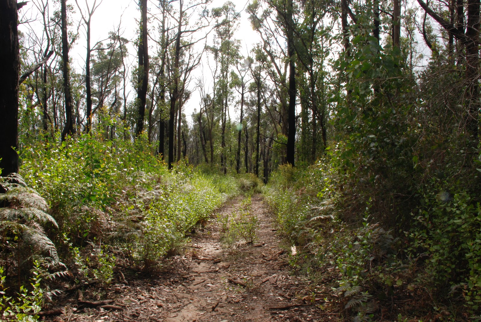
As we walked through the forest, we could still see evidence of the bush fires. Most of the eucalypts had blackened trunks and some were like skeletons.

However, it is wonderful to see how much the bush is in the
throws of regeneration. The lower story of the forest was thick with
wattles, goodenia and grass trees.

Eucalyptus trees were shooting new leaves and branches along their trunks
and many new saplings were stretching young foliage towards
the sun after shooting from seeds that were set in motion
from the heat of the fire.

We walked along Blackfish Way which followed the Blackfish Creek.
We didn't see any Blackfish.
Crossing the Kinglake-Glenburn Road we commenced our climb
up Andrews Hill following Andrews Hill Track.
 |
| It's just around the next corner, honest?! |
Nearly there!
And we made it!
Ian pointed out that if we did that climb ten times, we would have walked
the distance from sea level to the top of Mount Fuji in Japan.
No one wanted to join Ian in this feat.

Once we were at the top, we had lunch!

After lunch, it was all downhill.

We walked along Dusty Miller Track named after the indigenous,
prolifically growing shrub not the popular singer from the 70's.
Oh, that was Dusty Springfield, whoops.
prolifically growing shrub not the popular singer from the 70's.
Oh, that was Dusty Springfield, whoops.
 |
| There they are, all the way down there! |
This track finished at a T intersection with Mountain Creek Track.

Turning right onto Mountain Creek Track, we walked to the next
junction with Stringybark Track.
junction with Stringybark Track.
 |
| Eucalyptus saplings amongst blackened trunks |
After inspecting the sturdiness of the new metal signs, we took a right hand
turn onto Stringybark Track which we followed back
to the Island Creek Picnic Ground.
turn onto Stringybark Track which we followed back
to the Island Creek Picnic Ground.
 |
| It is screwed on! |
The sun shone through the young leaves of the gum trees,
creating a lovely afternoon glow as we walked through the regenerating bush.

It wasn't long before we were back at the picnic ground
enjoying a well earned cup of tea, tim-tams and teady bear biscuits.
(Thank-you Angela!)
 |
| Don't fall in! |
It was a great walk and wonderful to see that life can return after such devastation.
Click here for the stats of the walk.
In brief, we walked 12 kms and reached a breathing taking altitude 625m
and enjoyed ourselves immensely.
Walkabouters Club of Victoria Inc.
A0019863A


